

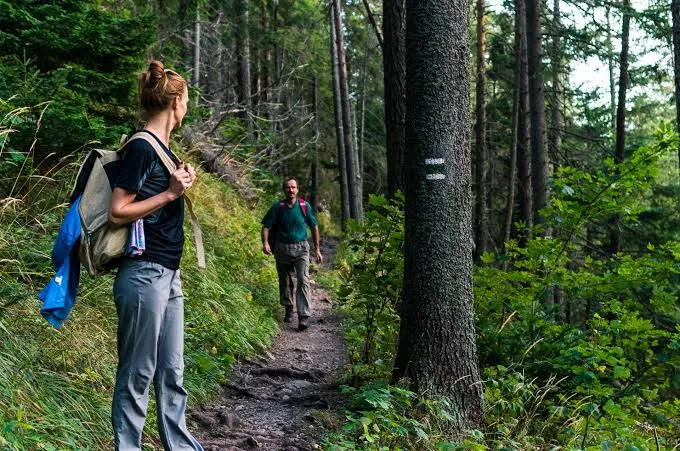
Two routes with the same distance can feel completely different. One may be a smooth, shaded path that welcomes casual walkers. Another may cross exposed hills, loose rock, or muddy ground that makes every mile slower. Learning to interpret route information helps you prepare for the experience rather than just the number on a map.
Good planning does not require expert-level navigation. It begins with a few specific questions about surface, slope, weather, access, and turnaround options. Those questions are particularly valuable when you are visiting an unfamiliar area or inviting someone with a different experience level.
Understand What Distance Does Not Explain
Distance is easy to compare, but it rarely tells the full story. A three-mile paved route may take less effort than a shorter path that climbs steeply and descends over loose stones. Review elevation gain together with total mileage and consider whether the route has one demanding section or repeated climbs.
Time estimates from other visitors are useful only as broad guidance. Rest stops, photo breaks, group size, heat, and individual pace can change a schedule. Set a turnaround time rather than assuming every outing will proceed at the speed suggested by an app.
Identify the Surface Underfoot
Gravel, compact dirt, pavement, sand, and rock behave differently when wet. A hard-packed route might be comfortable in dry weather but slippery after rain. Low areas can retain water, while roots hidden beneath leaves can create unexpected obstacles even on otherwise easy-looking terrain.
Check recent official updates for maintenance issues and damaged bridges. When comparing trails, look for surface descriptions instead of relying solely on labels such as easy or moderate. Those ratings are not universal and may overlook challenges that matter to individual visitors.
Read the Weather as a Route Factor
A pleasant forecast in the nearest city does not guarantee the same conditions along a wooded valley or higher ridge. Wind exposure, afternoon thunderstorms, and temperature differences can make a route more demanding. Look at the forecast for the specific area and consider how long you may be away from shelter.
Rainfall matters even after a storm ends. Some paths drain quickly; others stay muddy or cross swollen streams. If local agencies advise avoiding a route, choose an alternative. Turning around because conditions change is sensible decision-making, not a failed outing.
Know the Access and Exit Points
A route may have multiple entrances, but those entrances do not always connect to parking or public transportation. Confirm the official trailhead, gate hours, and any permits or fees. Also check whether the planned walk is a loop, an out-and-back trip, or a one-way route requiring transport.
If you will walk beyond a busy public area, save an offline map and tell someone your general plan. Cell service can be unreliable in wooded or remote locations. Marking junctions and a practical turnaround point helps prevent a minor navigation mistake from becoming a stressful delay.
Match the Plan to the People Going
The right route for an experienced runner may not suit a child, a beginner, or someone recovering from a long break from activity. Discuss preferred pace and comfortable duration before setting out. Ask about mobility needs without making assumptions, and check verified accessibility information where it exists.
Choose a conservative first outing with clear signs and easy access to the start. Bring enough drinking water for the conditions, wear appropriate footwear, and allow unhurried breaks. Group outings work best when everyone understands the plan and feels comfortable requesting a change.
Treat Reports as Clues, Not Guarantees
Photographs and reviews reveal useful details, but they capture a particular moment. A clear crossing shown last spring may now be closed for repairs. Visitor descriptions of difficult sections also vary according to footwear, confidence, and recent weather. Look for dates and corroborate important details.
Official land managers are the best place to check closures and permitted uses. Build a backup option into your plans, especially after severe weather. Preparedness allows you to enjoy unfamiliar scenery while remaining flexible about the exact distance or destination.
Conclusion
Route descriptions become much more useful when you read them as a combination of distance, terrain, weather, and access. With that context, you can make choices that suit the day and the people joining you. TrailCircuit supports the discovery side of outdoor planning, while current local guidance and thoughtful preparation remain essential.